A new United Nations-backed push to change how the world is represented on maps has unexpectedly brought the long-running Halaib and Shalatin dispute between Egypt and Sudan back into the spotlight.
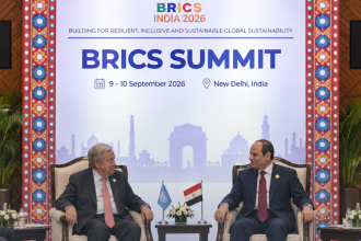
On September 4, 2026, the UN General Assembly overwhelmingly adopted the “Correct the Map” resolution, encouraging greater use of map projections that portray the relative sizes of continents more accurately. The resolution received 164 votes in favor, one against and six abstentions.
The initiative was led by Togo on behalf of the African Group and supported by the African Union, with much of the campaign focused on correcting the way the traditional Mercator projection makes Africa appear significantly smaller than its actual size.
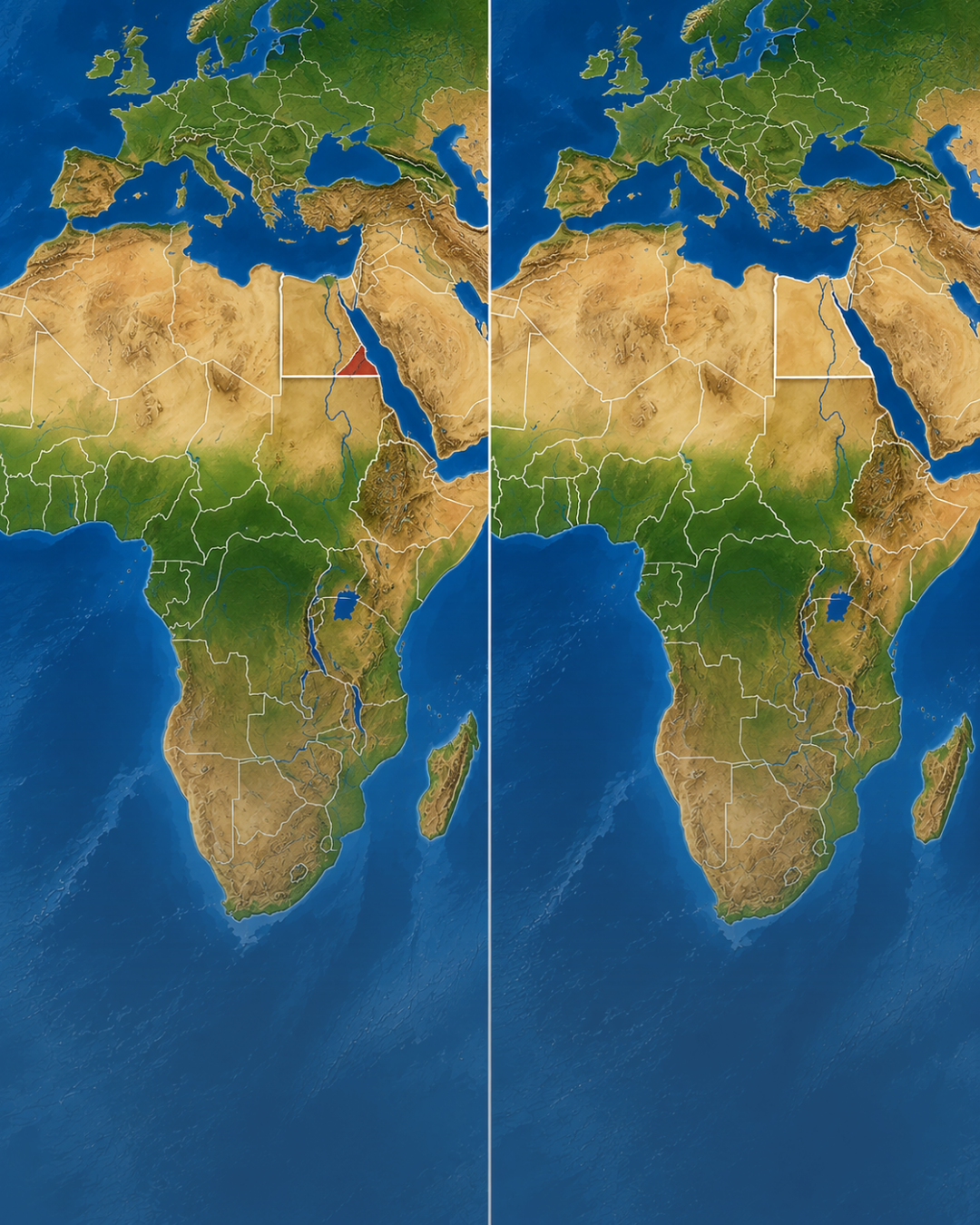
But shortly after the vote, another cartographic issue began attracting attention: how maps associated with the new projection depict the disputed Halaib Triangle on the Egypt-Sudan border.
Why Did Halaib and Shalatin Suddenly Become Part of the Debate?
Following the UN vote, Egyptian social media pages and some local media outlets circulated versions of the Equal Earth political map in which Halaib and Shalatin appear on the Egyptian side of the border.
This prompted claims online that the “new UN map” had effectively confirmed the territory as Egyptian. Egyptian outlet Scoop Empire, for example, reported on the appearance of Halaib and Shalatin within Egypt on the newly promoted map.
The issue also prompted criticism from Sudanese voices. Sudanese advocacy platform DAR Talks argued that maps appearing in media coverage following the UN vote depicted the disputed territory as Egyptian and questioned why a campaign intended to “correct” Africa’s map did not reflect Sudan’s territorial claim.
However, the situation is considerably more complicated than those reactions suggest.
Did the UN Recognize Halaib and Shalatin as Egyptian?
No.
The September 4 resolution concerns map projection, not international boundaries.
The purpose of the initiative is to encourage maps that preserve the true relative sizes of countries and continents rather than the distortions created by the Mercator projection.
Reporting on the resolution has explicitly noted that it does not affect the delimitation, status or recognition of international borders and should not be interpreted as taking a legal or political position on territorial disputes.
The UN vote therefore did not settle the sovereignty dispute between Egypt and Sudan.
It also did not amount to an international legal ruling that Halaib and Shalatin belong to either country.
What Is the Equal Earth Map?
The Equal Earth projection was developed in 2018 by cartographers Bojan Šavrič, Tom Patterson and Bernhard Jenny.
Unlike the familiar Mercator projection, Equal Earth is an equal-area projection, meaning that territories are displayed in their correct proportional sizes relative to one another.
One of the most famous examples of Mercator distortion involves Africa and Greenland.
On many conventional Mercator maps, Greenland appears roughly comparable in size to Africa. In reality, Africa is approximately 14 times larger.
The UN resolution encourages governments, schools, publishers, international organizations and technology companies to make greater use of Equal Earth or similar projections.
It does not ban Mercator, nor does it create a single legally binding political map of the world.
The Political Map Is Separate From the Projection
This distinction is particularly important in the Halaib debate.
Equal Earth describes the mathematical projection used to flatten the globe onto a two-dimensional map. It does not determine political borders.
The Equal Earth project’s own website acknowledges that geopolitical boundaries can be contentious and allows users to modify the political map data. It also states that the map’s creator does not endorse the political positions of people or organizations that use it.
In other words, the fact that one Equal Earth political map depicts a disputed area in a particular way does not transform that depiction into a UN judgment on sovereignty.
What Is the Halaib Triangle?
The Halaib Triangle is a roughly 20,580-square-kilometre area on the Red Sea coast claimed by both Egypt and Sudan.
It includes Halaib, Abu Ramad and the wider Shalatin area and is currently administered by Egypt, while Sudan continues to maintain a sovereignty claim.
The dispute originates from two different colonial-era boundary arrangements.
An 1899 Anglo-Egyptian agreement defined the political boundary between Egypt and Sudan largely along the 22nd parallel north.
Under that line, the Halaib Triangle falls on the Egyptian side.
In 1902, however, British administrators established a different administrative boundary intended to reflect tribal movement and local administration.
That arrangement placed the Halaib area under administration from Sudan. Sudan relies heavily on the 1902 arrangement in its claim, while Egypt maintains that the 1899 political boundary remains the legally valid international frontier.
Egypt Currently Administers the Territory
Whatever the competing legal arguments, the current situation on the ground is clearer.
Egypt exercises de facto administrative control over the Halaib Triangle and treats the territory as part of its Red Sea Governorate.
Sudan, however, has never formally abandoned its claim.
The dispute therefore remains unresolved at the diplomatic level even though Egypt administers the territory.
Sudan Renewed Its Claim in 2026
The controversy surrounding the new map is also unfolding in a year when the dispute had already been formally renewed at the United Nations.
On January 5, 2026, Sudan’s permanent representative asked for the country’s longstanding 1958 complaint relating to the border dispute to remain on the list of matters before the UN Security Council.
Egypt responded on February 6.
Its permanent representative reaffirmed Egypt’s previous communications to the Security Council asserting Egyptian sovereignty over the Halaib and Shalatin Triangle.
That exchange confirms that, despite political developments in both countries, the competing claims remain active in 2026.
A Map Does Not Resolve a Territorial Dispute
The latest controversy highlights an important distinction between cartography and international law.
Maps can depict territorial claims, administrative control or boundaries according to the data chosen by their creators. But a particular map’s coloring does not by itself determine sovereignty.
The UN-backed “Correct the Map” initiative was primarily created to deal with a completely different cartographic problem: the distortion of landmass sizes on conventional world maps.
Its resolution does not decide whether the 1899 or 1902 boundary should govern Halaib.
That question remains disputed between Cairo and Khartoum.
Why the New Map Still Matters
Although the Equal Earth vote did not settle the border question, its widespread circulation has given the dispute new visibility.
For Egyptians, maps depicting the territory within Egypt reflect Cairo’s longstanding position that the international border follows the 22nd parallel.
For Sudanese supporters of Khartoum’s claim, those same maps can be viewed as ignoring the 1902 administrative boundary on which Sudan bases its case.
That is why a UN resolution intended primarily to correct the visual size of Africa has ended up reopening discussion around one of northeast Africa’s longest-running territorial disputes.
The most accurate conclusion is therefore not that “the UN recognized Halaib and Shalatin as Egyptian.”
Rather, the UN backed a new approach to world-map projection, and political maps circulated in connection with that decision have reignited debate over a territory that Egypt administers and both Egypt and Sudan continue to claim.